The Skagit Valley in Bloom
The Skagit Valley Tulip Festival transforms a quiet patchwork of working farmland, into sweeping bands of color, drawing visitors from around the world.
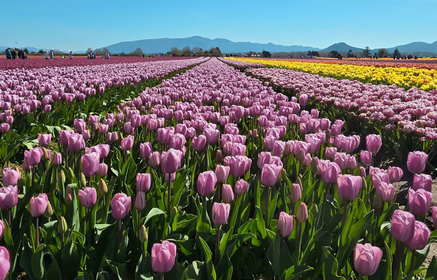
The Skagit Valley exists because of the Skagit River. Over thousands of years, the river carried sediment out of the North Cascades, building the broad, fertile Skagit Delta. Glaciers ground mountain bedrock into fine mineral sediment known as glacial flour, which meltwater and mountain streams carried into the river system. Glacier Peak has also been a major source of sediment carried into the Skagit Valley. Eruptions, landslides, and volcanic mudflows called lahars sent rock, ash, and sediment down the White Chuck and Sauk rivers into the Skagit, with some prehistoric flows reaching Puget Sound.
Destination Highlights
Glacial Silt to Nature’s Turban
The Skagit Valley’s fertile farmland is the latest chapter in a land shaped by glaciers, river, and tide. It has sustained Coast Salish communities for generations, with the river and delta providing food, travel, and trade while shaping a deep relationship with the land and water.
The rich soils of the Skagit Delta made this remote landscape an inevitable target for agricultural expansion. Settlers and farmers built dikes, drained the tidal marshes and, with a lot of hard work, transformed the land into a breathtaking patchwork of world-famous flower fields, drawing hundreds of thousands of visitors each spring.
Mother of the Skagit Valley’s Bulb Industry
Mary Brown Stewart arrived on Samish Island from Ohio in 1903. The Skagit Valley was already rich farming country, but flowers were hardly an obvious crop. Inspired by the tulips her mother had grown in the Midwest, Stewart took a gamble. In 1906, she ordered a boatload of bulbs directly from Holland. Neighbouring farmers were skeptical, but the tulips flourished in the valley’s rich soil and cool coastal climate.
What began in Mary’s personal garden grew into a flourishing mail-order business called Tulip Grange Inc. Her son Sam later expanded the family operation onto the Skagit Flats near La Conner. Mary’s experiment helped kick-start what would become the valley’s emblematic industry. It earned her recognition as the “Mother of the Skagit Valley’s Bulb Industry.”
- The Woman Behind the Tulips→ Cascadia Daily News article tracing her role in starting the valley’s tulip industry.
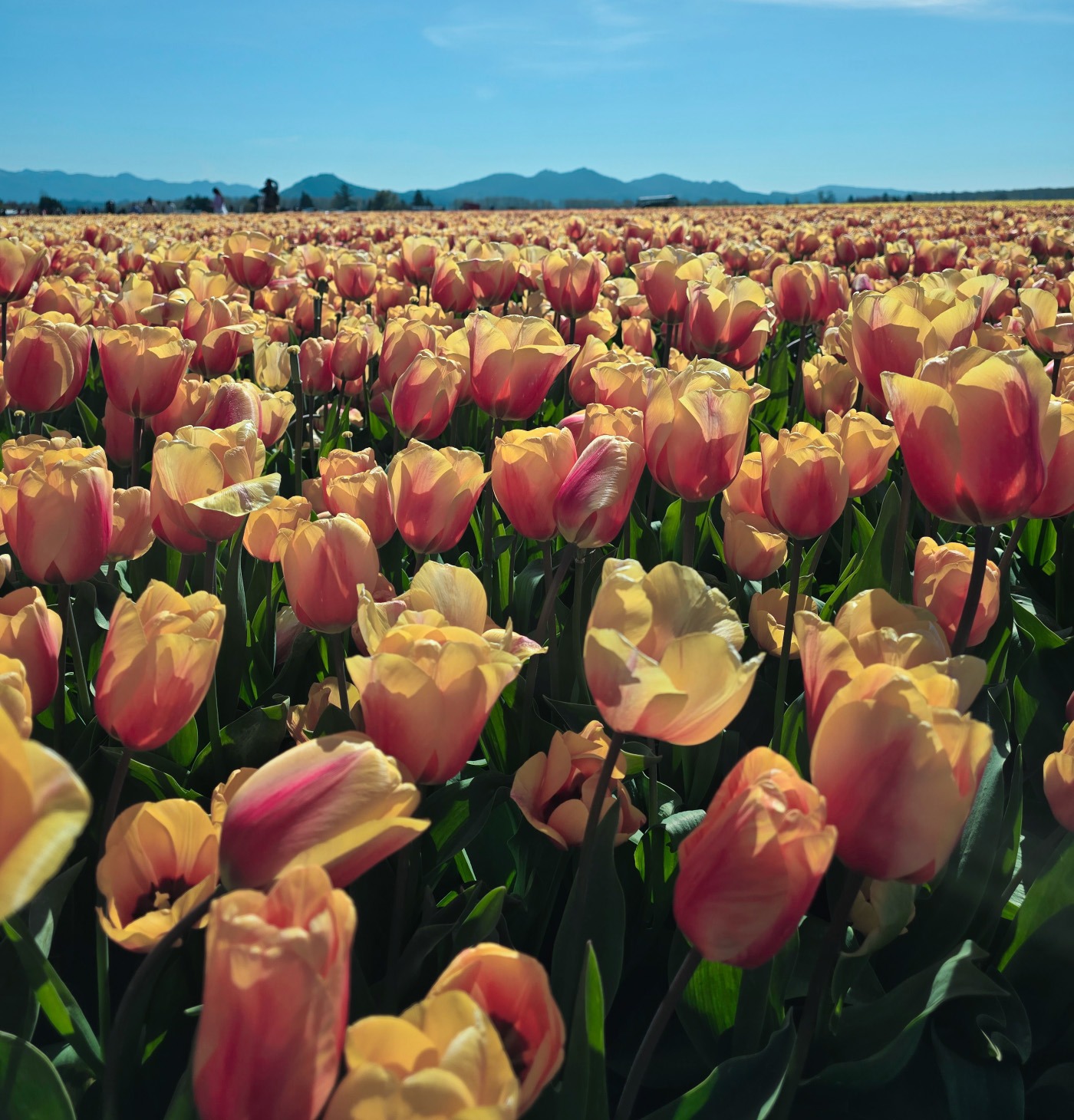
Fields of peach and golden tulips stretch across the Skagit Valley
The Dutch Legacy
William Roozen arrived from the Netherlands in 1947, bringing generations of Dutch bulb-growing experience to the Skagit Valley. He initially worked for established growers before striking out on his own.
Roozen brought Dutch expertise and a much larger commercial vision to the valley. Over the following decades, the family’s growing operation became one of the largest producers of tulips, daffodils, and irises in the United States. Its sweeping fields helped establish the Skagit Valley as one of North America’s premier flower-growing regions.
But the flowers were becoming more than a crop. Each spring, increasing numbers of visitors came simply to see the fields in bloom. Their growing popularity helped lead to the creation of the Skagit Valley Tulip Festival in 1984. Today, the family welcomes visitors to RoozenGaarde, established in 1985 as its display garden. The name is a clever nod to the family’s Dutch heritage: “Roozen” echoes the Dutch word for roses, while “gaarde” means garden, giving RoozenGaarde the sense of a “rose garden.”
The Skagit Valley Tulip Festival
The Skagit Valley Tulip Festival is a month-long celebration held throughout the valley. The gardens are miles apart, making this a driving tour. Visit Tuesday through Thursday for lighter traffic, or arrive early or later in the afternoon on weekends. Wear layers and waterproof footwear because paths may remain muddy. Free parking is available at every garden, but never park along the roadside. Enter only designated visitor areas, as the surrounding production fields are working crops on private land.
The gardens lie between Mount Vernon and La Conner, making it easy to combine a morning visit with lunch and the waterfront in La Conner or Mount Vernon’s Riverwalk, shops, and Tulip Festival Street Fair.
- Skagit Valley Tulip Festival → Official festival information and visitor planning
- Bloom Status → Current garden and field conditions
- Festival Map and Directions → Garden locations, driving routes, and traffic guidance
Skagit River to the Salish Sea
The Skagit Delta, La Conner, and Deception Pass follow the landscape from river to sea, bringing together the history, wildlife, and scenery that make this corner of the Pacific Northwest worth exploring.
The Skagit Delta
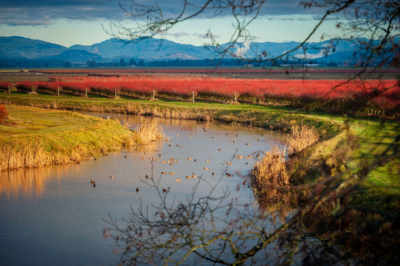
The rivers, tidal flats, and estuaries of the Skagit Delta are part of the ancestral homelands of Coast Salish peoples, who travelled these waterways and relied on their abundant salmon, shellfish, waterfowl, and other resources. In the 1870s, Skagit City became the region’s primary river port, where sternwheelers docked among hotels, saloons, and warehouses. The settlement has almost entirely disappeared, leaving the restored Historic Skagit City School as a reminder of when the river, rather than the road, was the valley’s highway.
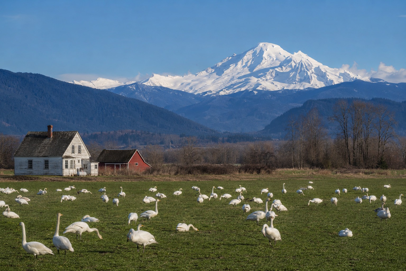
As the Skagit approaches Puget Sound, farmland gives way to Fir Island and the tidal wetlands of Wiley Slough. In the colder months, thousands of snow geese and trumpeter swans gather across the fields, while at Fir Island Farm Reserve, working farmland meets restored estuary, providing habitat for salmon, waterfowl, and shorebirds.
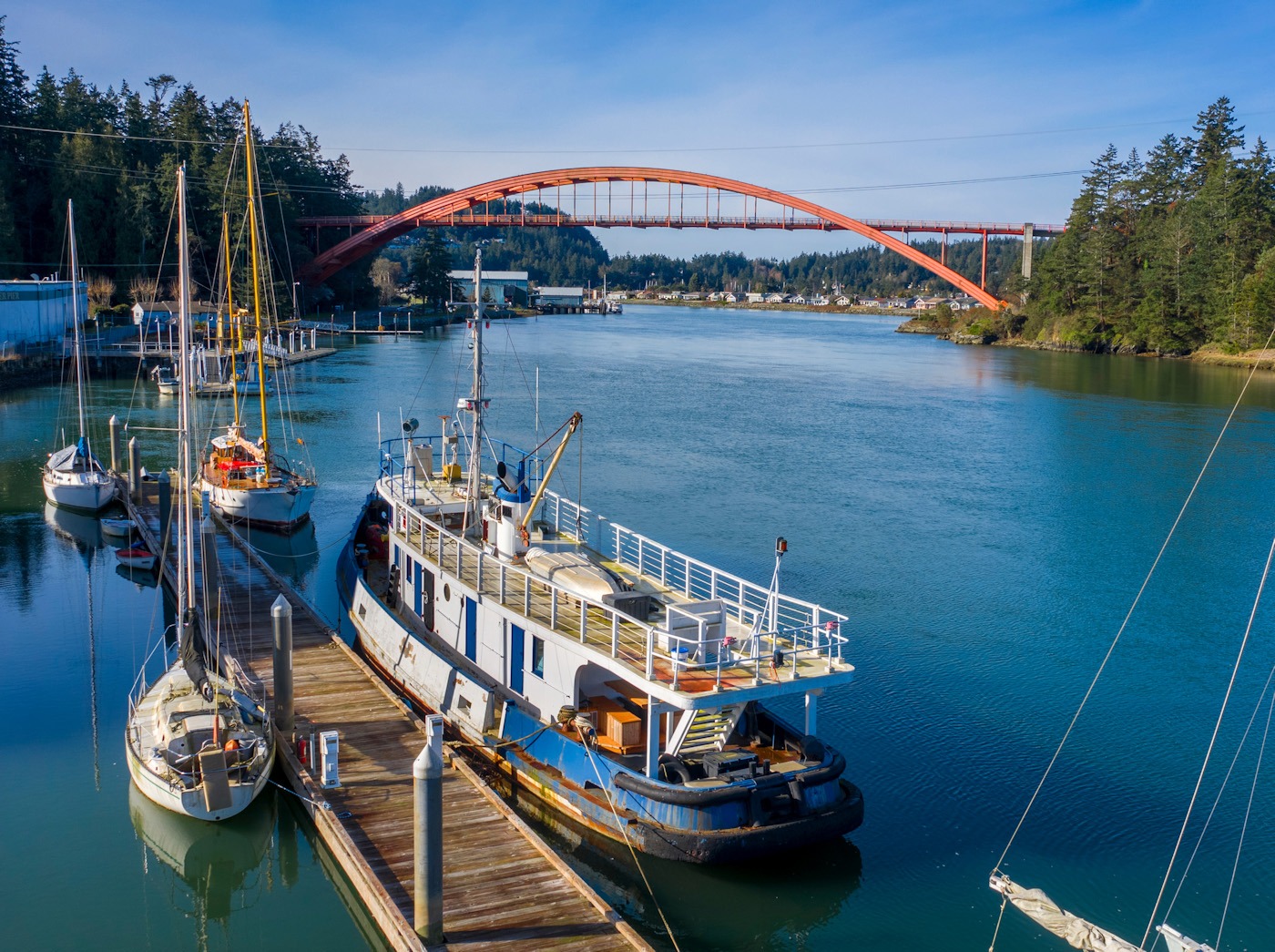
La Conner
La Conner is a historic waterfront village where the fertile fields of the Skagit Valley meet the tidal currents of the Swinomish Channel. Established as a non-Native settlement in the 1860s within the ancestral homelands of Coast Salish peoples, it grew into a maritime hub for steamships travelling throughout Puget Sound. Its history remains visible along the compact waterfront, while a strong artistic tradition continues in the town’s galleries, sculptures, and museums.
Today, the Boardwalk follows the channel past restaurants, galleries, small shops, marinas, and passing boats, while the orange arc of the Rainbow Bridge rises above the water toward Fidalgo Island. Spring brings nearby tulip and daffodil fields and winter brings swans and snow geese, but La Conner’s waterfront makes it worth lingering in at any time of year.
- Museum of Northwest Art (MoNA)→ Pacific Northwest and Indigenous art, including work connected to the region’s influential Northwest art movement
Deception Pass
West of the Skagit Valley, open farmland gives way to the forested islands and dramatic coastline of Deception Pass State Park, one of the most celebrated state parks in the Pacific Northwest. At its heart, Deception Pass Bridge rises high above the narrow channel separating Fidalgo and Whidbey islands, where powerful tidal currents flow between the Strait of Juan de Fuca and the Salish Sea. Viewpoints near the bridge look down on the turbulent passage offering spectacular views as the setting sun lights the water and silhouettes the bridge and islands.
Washington’s most-visited state park stretches across both sides of the channel, with old-growth forest, beaches, freshwater lakes, and miles of trails. On the Fidalgo Island side, Rosario Beach is a particularly scenic place to stop, with a grassy park overlooking the water and a short trail looping around the headland. The trail opens to beautiful views across the Salish Sea, making Rosario Beach an especially memorable place to watch the sunset. It is also home to the Maiden of Deception Pass, a sculpture honoring the Coast Salish heritage of the area. Nearby, Bowman Bay offers another quiet stretch of shoreline and a coastal trail toward Lighthouse Point.
- Washington State Parks → Official Deception Pass State Park information, current conditions, maps, and Discover Pass details.